
Islands from Space
THANKS TO ADVANCES IN SATELLITE TECHNOLOGY, PRIVATE COMPANIES LIKE PLANET ARE NOW PROVIDING CONTINUOUS COVERAGE OF THE EARTH FROM SPACE — INCLUDING ALL THE ISLANDS CLEAN WAVES IS PROTECTING

Planet satellites launching into orbit from the ISS. Photo by NASA.
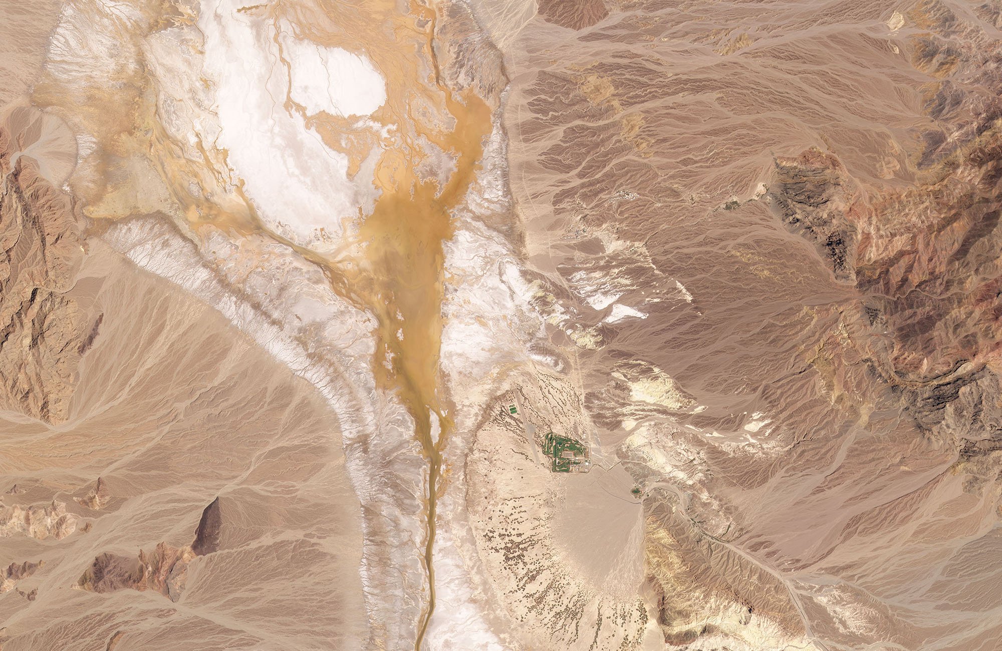
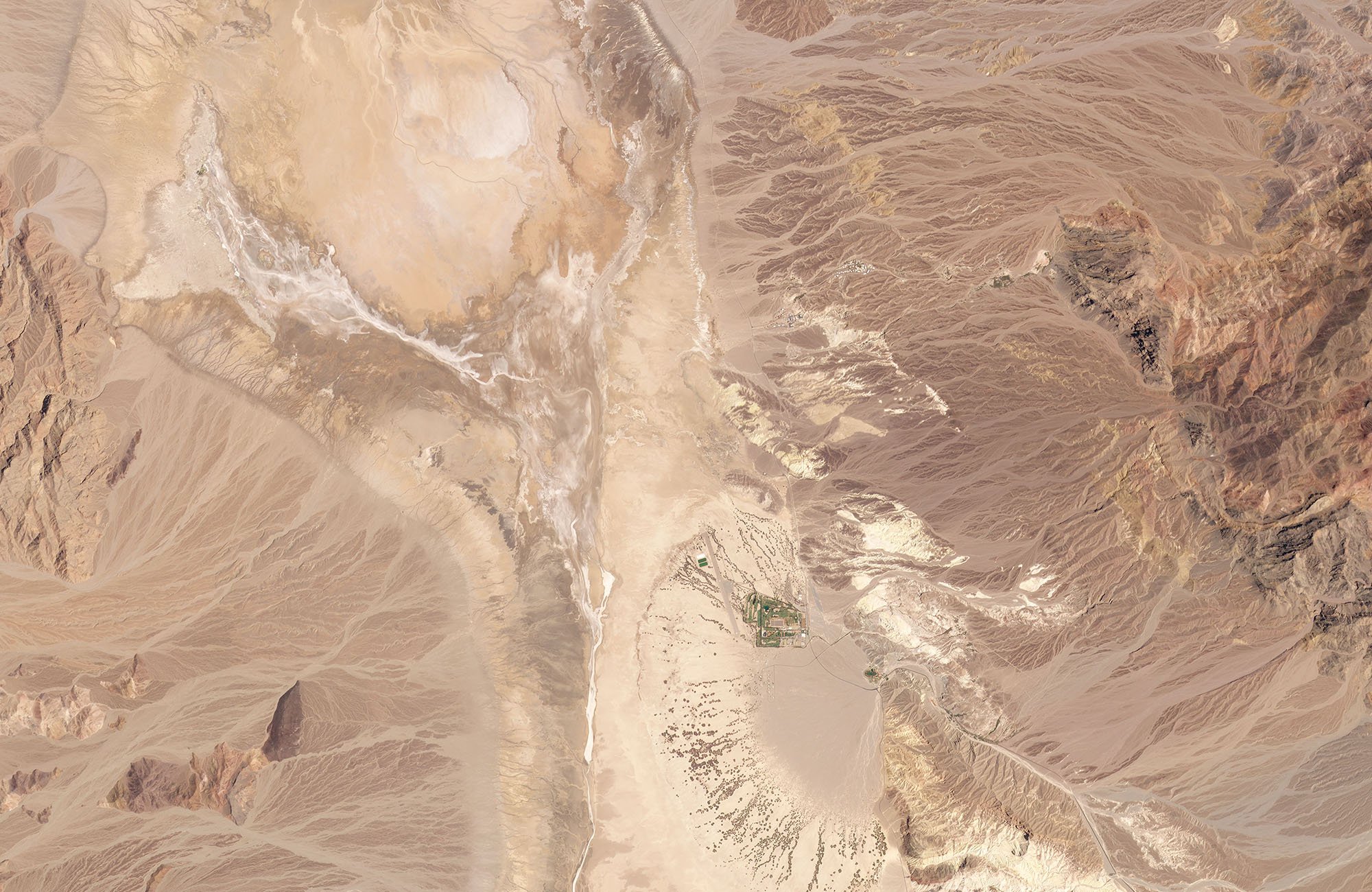
Advances in miniaturization and other technology have launched a whole new era of planetary observation from space, giving us a new view of our home planet.
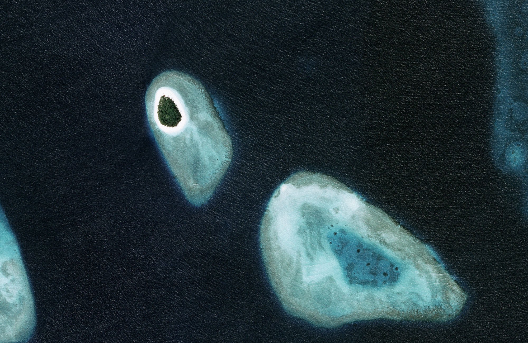
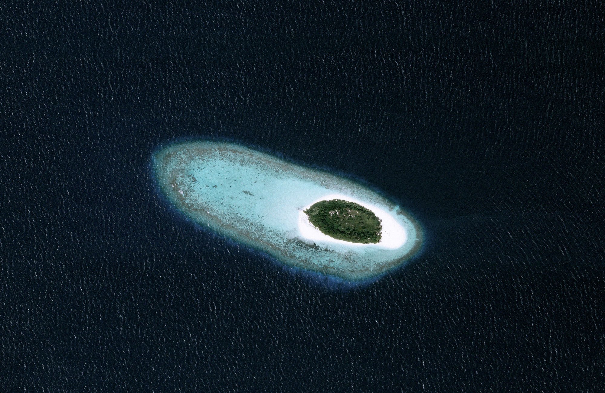
Private companies like Planet are now collaborating with space agencies and scientists to monitor our changing Earth in real time – and even helping to pinpoint carbon and methane emission sources. As part of their commitment to helping NGOs, Planet has graciously been providing all the incredible satellite imagery you see of the islands we’re protecting with Clean Waves. We caught up with Melissa Rosa, Planet’s Impact Manager, to chat more.
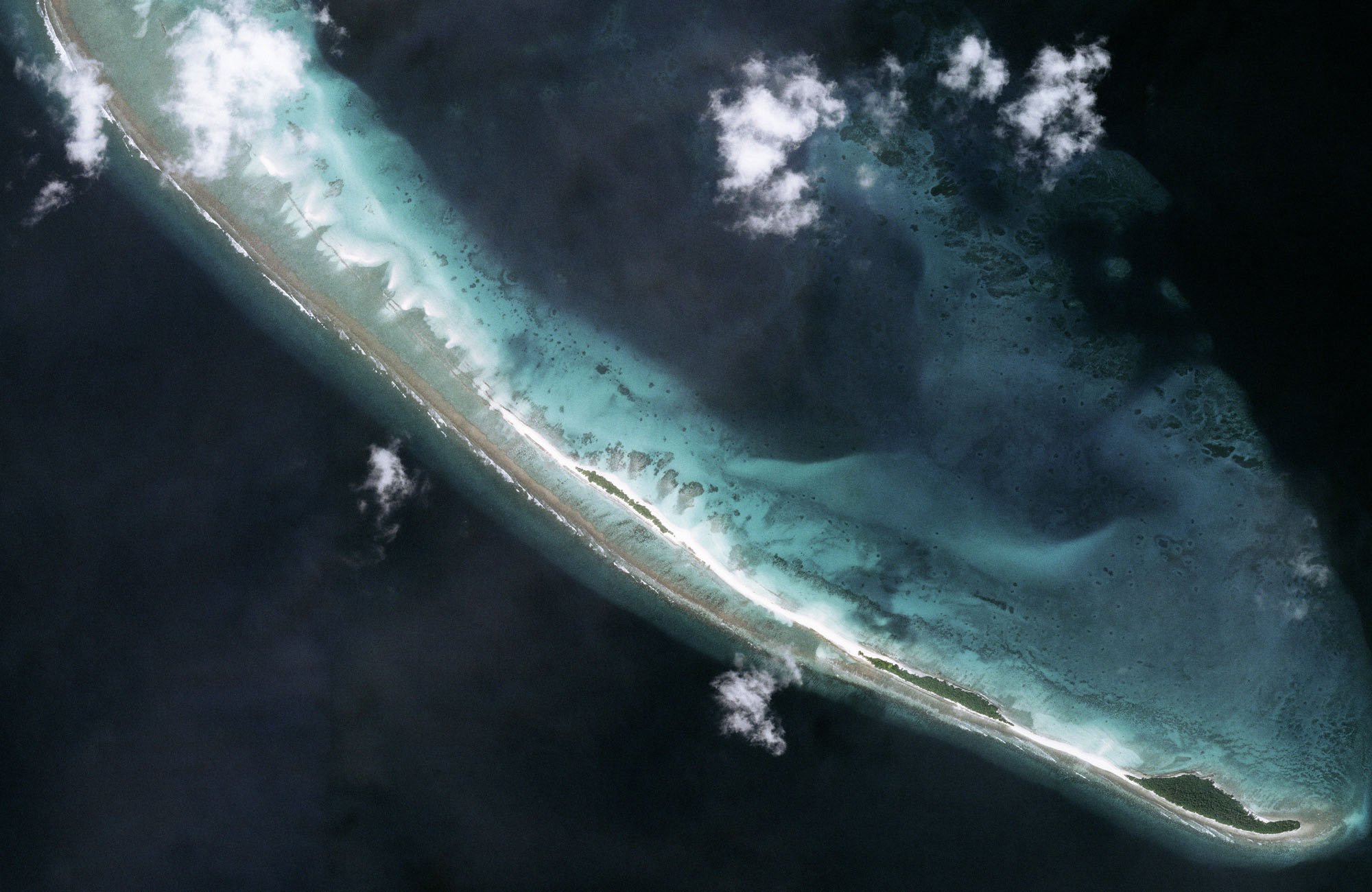
Moorea
So how are Planet satellites different from existing ones?
Traditional satellites are very large – roughly the size of a bus – and are typically owned and operated by government agencies. They usually cost several billion dollars to build and launch into orbit. Our new Dove satellites, on the other hand, are about the size of a shoebox, allowing many of them to be stored in a rocket at one time. These satellites cost a fraction of the price to make and launch, and now with approximately 200 Dove satellites in orbit, Planet is able to collect daily, high-resolution (roughly 3m) global imagery of our changing Earth. We also have a number of tasking satellites, called SkySat, which can capture finer details (50cm resolution) of specified locations up to 10 times a day.
What are the key innovations that paved the way to make this possible?
Advances in the miniaturization of cameras and GPS systems, like those now found in your average mobile phone, were a catalyst for the development of Planet’s small, highly capable satellite constellation. With an agile aerospace approach, we can go through a loop of rapid prototyping, evaluation and iteration to advance innovation. This agile process, which is also used by private rocket companies, has led to more frequent global launches – increasing the number of times our satellites can be sent into orbit.
What has Planet’s growing constellation allowed you to do, in terms of environmental work and other impact projects?
Our Dove satellites are capturing daily environmental change and helping us better understand our own impact on our planet. For example, NASA has used our data to evaluate the rate of melting glaciers; tropical countries around the world are using our datasets to monitor the health of their rainforests and combat illegal deforestation; and researchers are incorporating our images into wildfire models to better understand fire behavior and how to mitigate risk in coming seasons. Our work even extends to helping companies and governments make informed and ethical supply chain management decisions, like ensuring global food security and protecting biodiversity.

Occidental Glacier, Chile
“We are able to visualize greenhouse gasses to help provide a more complete and precise measurement of methane and carbon dioxide leaks.”
What role can companies like Planet play in fighting climate change?
Planet is currently supporting a number of projects to combat climate change. Our data is used by Climate TRACE, a coalition of climate focused NGOs, technology companies, and universities that track and make information regarding greenhouse gas emissions publicly available in an effort to hold organizations accountable for their emissions and reduce carbon in the atmosphere. We are also a partner in Carbon Mapper, a non-profit organization focused on detecting carbon dioxide and methane emissions at their point source. For that project, we’re working with NASA’s Jet Propulsion Lab to create a hyperspectral satellite for Carbon Mapper that will be able to visualize these greenhouse gasses to help provide a more complete and precise measurement of methane and carbon dioxide leaks. On a company operations level, we are also a carbon neutral company and work directly with one of our customers, Pachama, to offset our carbon footprint and support communities and biodiversity conservation within global forests.
What’s your personal favorite thing on Earth to look down upon and see in Planet images?
There are so many that it’s hard to choose just one! Looking down the caldera of an active volcano is pretty amazing. I’m also fascinated by hydrological features, especially rivers – the way they meander and stretch across the landscape. It’s something you can’t see very well on the ground and Planet’s daily satellite imagery is particularly well suited for capturing their dynamic nature, especially during flooding events.

Deforestation in Chiribiquete, Colombia


Since we’re Parley, we have to ask – are there any particular highlights or amazing sights in the oceans that Planet has imaged since you started?
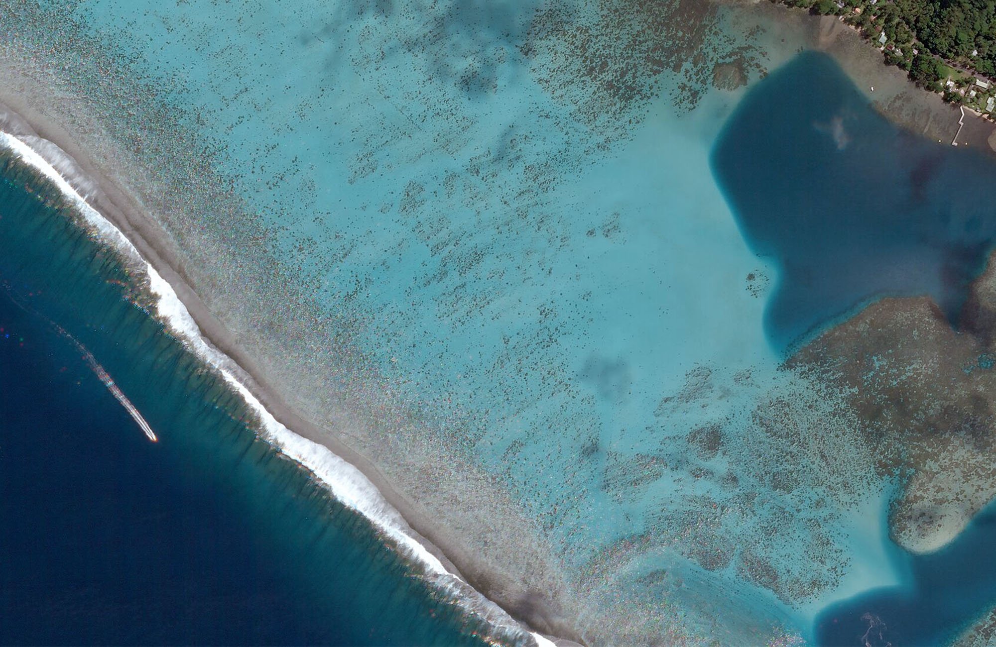
Over the last few years, Planet has contributed to an exceptional project called the Allen Coral Atlas, an ambitious initiative to map all of the world’s shallow tropical coral reefs. Our satellite images created the base-level mosaic for the global coral reef map, revealing coastal structures and spatial patterns in these beautiful and vulnerable ecosystems. Each and every one of these sights is really a wonder to view from space.
What would you say to detractors and public criticism about space development and exploration – “It’s a waste of money” “What about the emissions from each launch?” etc?
We are currently in a space exploration renaissance where companies can rapidly build, prototype and iterate new technologies each day to make exploration of our own planet and beyond more accessible and less expensive than ever before. Overall, the scientific insights that our society gains from space exploration and earth observation datasets help us better understand how to sustainably manage our world. This investment can be invaluable for creating a more secure and prosperous world that will benefit the future of our human society.

Manitoba, Canada
“Satellites are capturing daily environmental change & helping us better understand our own impact on our planet.”

Rakaia River, New Zealand
Browse and download the latest Planet images from space – free!